

Meall a' Ghiuthais [Meall a' Ghiubhais]
Good walks are even better shared.
NG9763 : West ridge of Meall a' Ghuibhais
Trevor Littlewood Photo source
Overview
Meall a' Ghiuthais: A Gem in the Scottish Highlands
Meall a' Ghiuthais, standing proudly at 900 meters, is a must-visit for any hiking enthusiast keen to explore the rugged beauty of the Scottish Highlands. Nestled near the picturesque village of Glendale, this Munro offers an engaging challenge along with breathtaking vistas.
Geology
The mountain is primarily made up of Lewisian gneiss, showcasing the geological history of Scotland that spans billions of years. As you traverse the rugged terrain, take a moment to appreciate these ancient rocks; they’ve been working hard since your great-great-great-grandparents were running around naked in the prehistoric wilds!
Routes
A popular choice is the Glendale Circuit, which is a 12 km moderate hike that typically takes around 5 hours. Starting from the charming village of Glendale, this route meanders through lush grasslands and rocky outcrops, ensuring a dynamic experience. It’s a circular route, so don’t worry about getting lost in the mists of time—or the mists of the Highlands, for that matter!
Summit Features
At the top, you’ll encounter a rugged stone cairn, which is more than just a pile of rocks; it’s a symbol of achievements and triumphs. It offers an excellent backdrop for those vital summit selfies. Don’t forget to congratulate yourself for reaching the top!
Terrain Type
The terrain primarily consists of grassy hills with rocky outcrops, especially near the summit. Prepare for a bit of a scramble at times, and ensure you wear sturdy footwear to navigate the occasional trickster rock underfoot.
Views
On a clear day, the views are simply awe-inspiring. To the north, the majestic Cuillin peaks loom, while the blue expanse of the North Atlantic spreads before you. For the best views, aim for spring or autumn when the visibility is at its peak.
Hazards
While Meall a' Ghiuthais is a rewarding experience, it’s crucial to remain cautious. The weather can be notoriously fickle; one moment you could be basking in sunshine, and the next could see you swallowed by fog. Slippery paths after rain are also a concern, so make sure you pack utmost care and equipment.
Access
The nearest parking is at the end of a single-track road to Glendale, about 2 km from the hike's start. Public transport is limited but there are buses that run from Portree. The closest town is Portree, approximately 25 km away, where you can stock up on essentials before hitting the trail.
Facilities
Facilities in the immediate area are limited, so it’s wise to bring along your provisions. However, Portree boasts various cafes that can help fuel your adventure – or just ensure you have something nice to look forward to post-hike!
History
The name Meall a' Ghiuthais translates to 'Hill of the Spruce', hinting at the lush woodlands that once flourished here. Over the years, it has played a significant role in local folklore and as a resource for local clans’ hunting grounds. When you walk these ancient slopes, remember both the history that lies beneath your feet and the adventures that await.
Happy hiking—may your trails be ever upward and your views ever clearer!
Explore routes near Meall a' Ghiuthais [Meall a' Ghiubhais]
Walks starting near this hill. Open a route to check its map, distance and full itinerary.
Beinn Eighe Lancaster Wreckage at Coire Mhic Fhearchair
View route
Fairy Lochs Liberator Wreckage Circuit
View route
Loch Affric full circuit from River Affric
View route
Glen Affric: Coire Loch Woodland Trail
View route
Route planning notes
These notes describe possible approaches. Check a route's map and access information when planning your walk.
Glendale Circuit
A popular circular route starting from the village of Glendale, offering stunning views throughout the hike.
Make a day of it, together
Find someone to share the walk with, or organise a day out along a route you like.
Photo Gallery
View all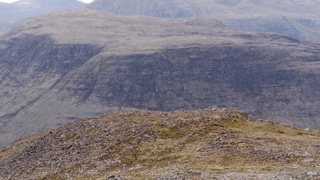 Photo could not load
NG9763 : West ridge of Meall a' Ghuibhais
Trevor Littlewood
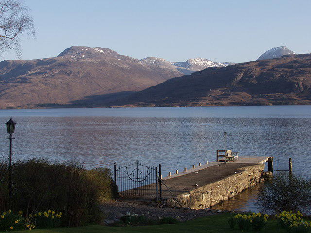 Photo could not load
NG9763 : Meall a Ghiubhais (878 m)
Mick Crawley
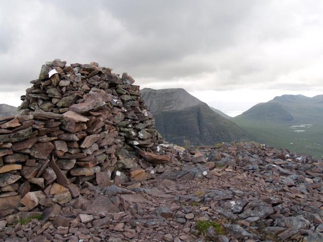 Photo could not load
NG9763 : Summit Cairn, Meall a Ghiubhais
Chris Eilbeck
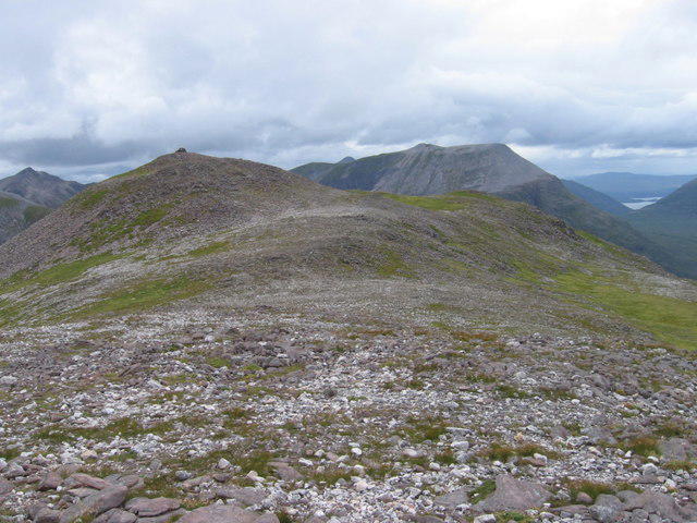 Photo could not load
NG9763 : Meall a' Ghiuthais
Chris Wimbush
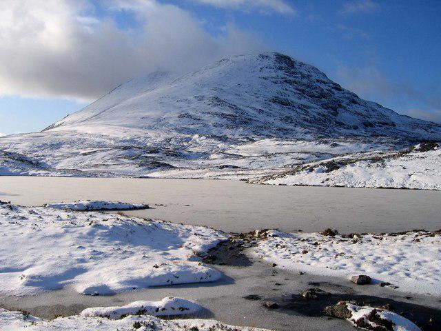 Photo could not load
NG9763 : Meall a' Ghiuthais
Robert W Watt
Hill facts and local notes
Classifications
Elevation
887m
2,910 ft
Prominence
418m
Coordinates
57.6152, -5.3902
NG976634
OS Map
19
Explorer: 433
At the Summit
The summit features a substantial stone cairn, perfect for those Instagram-worthy shots or just as an excellent location for a well-deserved snack break.
Terrain & Geology
Meall a' Ghiuthais is primarily composed of ancient Lewisian gneiss, which is one of the oldest rocks in Scotland, dating back approximately 3 billion years. Its rugged appearance is a testament to the geological history of the region, shaped by glaciers during the Ice Ages.
Views & Scenery
From the summit, you can see the striking peaks of the Cuillin range on Skye, as well as the expansive vistas across the Isle of Raasay. On clear days, the blue hues of the North Atlantic Sea are particularly breathtaking.
History & Heritage
Name Origin
The name Meall a' Ghiuthais translates roughly to 'Hill of the Spruce'. The hill's name reflects the ancient woodlands that once covered the Highlands.
Historical Significance
The area is steeped in Scottish folklore and was historically important as a hunting ground for local clans.
Getting There & Facilities
Parking
There is parking available at the end of the single track road leading to Glendale, roughly 2km from the start of the trail.
Public Transport
Public transport options are limited, but there are bus services from Portree which can drop you off at Glendale.
Nearby Facilities
Facilities are quite sparse in the area. It’s advisable to plan ahead and bring your own refreshments, though there are small cafes in Portree for before or after your hike.
Safety Information
Known Hazards
- Be aware of sudden weather changes, as conditions can shift rapidly in the Highlands. The path can be slippery, especially after rain, and dense fog can reduce visibility.
General Safety Tips
- Check weather conditions before setting out
- Carry appropriate clothing and equipment
- Let someone know your planned route
- Take a map, compass, and GPS device
- Carry emergency supplies: food, water, first aid kit, torch
Hills
Some common questions about the hills answered
Are there group walks up Meall a' Ghiuthais [Meall a' Ghiubhais]?
Many walkers use Walkmates to join or organise walks with others. You can check for group walks around Meall a' Ghiuthais [Meall a' Ghiubhais] through the maps
Are there other walkers around Meall a' Ghiuthais [Meall a' Ghiubhais]?
Activity varies by location and time, but Walkmates lets you see whether others have shared walks or shown interest in this area. Find other people through the walking friends search walking friends for Meall a' Ghiuthais [Meall a' Ghiubhais] search or of course create your own walk for Meall a' Ghiuthais [Meall a' Ghiubhais]
Can I organise a walk to Meall a' Ghiuthais [Meall a' Ghiubhais]?
Yes. If there aren’t any walks listed already, you can create a walk and make it available for others to join.
If you're signed up to Walkmates, you can create a walk to Meall a' Ghiuthais [Meall a' Ghiubhais].
How do I find a walk up this hill?
There are often multiple ways to walk this hill, depending on experience and route preference. Walkmates helps you explore walks and routes that others have shared.
Can I suggest a new route up Meall a' Ghiuthais [Meall a' Ghiubhais]?
Yes. You can suggest or create routes to share with others. Walkmates focuses on the social side of walking, so routes are used to help people organise walks and explore areas together, rather than as detailed navigation tools or route libraries.
Other uses really appreciate knowledgeable walkers sharing their routes. Share your favourite route to Meall a' Ghiuthais [Meall a' Ghiubhais] here
The is an error or something incorrect about this hill. How do I let you know?
We always strive to keep the information on Walkmates as accurate as possible. If you find an error, please let us know through the contact form and we'll aim to correct it as quickly as possible
Community Discussion
Comments
Location
![Meall a' Ghiuthais [Meall a' Ghiubhais] location map](https://cdn.walkmates.com/hill-maps/hill-sources/972/57.61518_-5.39020.png)
Grid reference: NG976634
View on OpenStreetMapOpens a map in a new tab, centred on the hill.
No comments yet. Be the first.